The (Interactive) Global Sharknado Threat
Lifted directly from John Nelson using his styling, I present an interactive web-based version of his instant classic The Global Sharknado Threat map
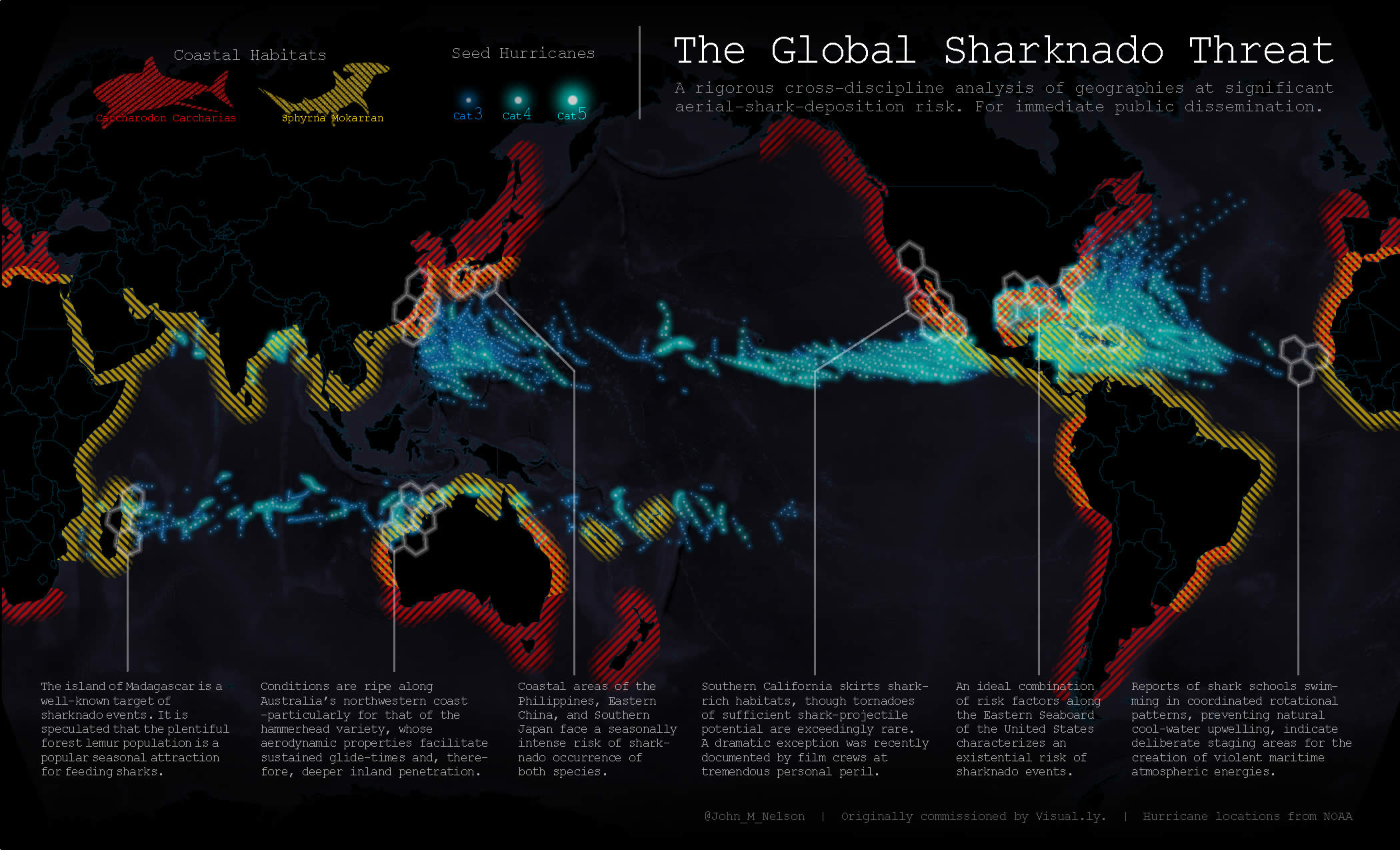
In John's words, "This is The Global Sharknado Threat Map. Created by an unprecedentedly cross-discipline team of nameless chain-smoking scientists in white lab coats, this map is intended as a resource to coastal communities regarding the nature and likelihood of a sharknado incursion. Right?"
In my words - this map is amazing. I'm using the data on his tutorial page from noaa hurricanes since 1891, catagories 3, 4 and 5 plus Great White and Hammerhead shark populations and habitat data.
These are Great White and Hammerhead shark habitats distance from the coastline to 250m offshore.
The shapefiles (converted to geojson in QGIS) from NOAA hurricanes since 1891, categories 3-5.
The Interactive Global Sharnado Threat Map
Shark Habitats
Hurricanes (Category 3-5) since 1891